Portfolio
Canadian Geographic
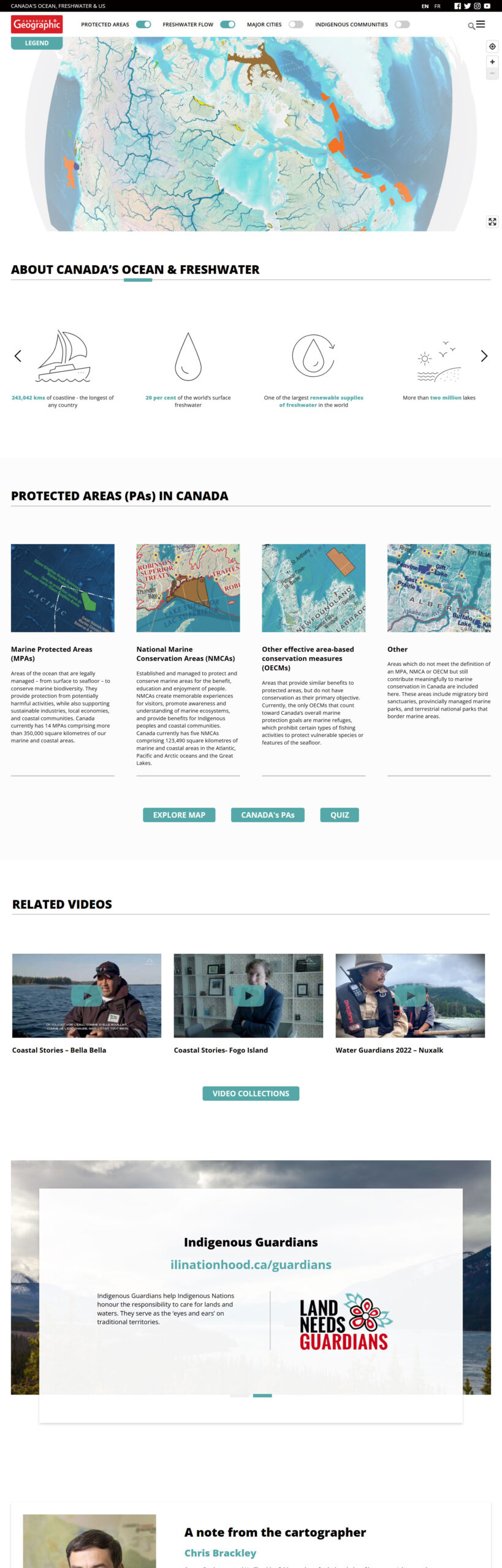
Building an Interactive GeoJSON-Powered Map for Canada's Ocean and Freshwater Systems
We developed the Canada Ocean Map to provide an interactive, data-rich experience that connects Canadians with their ocean and freshwater environments. Utilizing GeoJSON technology, the map visualizes key information such as marine protected areas, freshwater flow patterns, Indigenous territories, and political boundaries, all layered seamlessly for user engagement.
Designed for both educational and policy-making purposes, the platform offers intuitive navigation and responsive design, ensuring accessibility across devices. By integrating authoritative datasets, we created a tool that fosters a deeper understanding of Canada’s vast and interconnected water systems.
Webiste designed by: Sweet Imagery